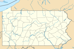
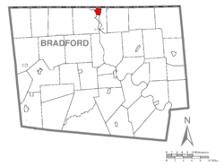
The Penn-York Valley (referred to locally as The Valley) is a group of communities that straddles the New York and Pennsylvania border.It includes the villages and boroughs of:
These four central communities have a population of 14,822 as of the 2000 Census, and a population of 14,425 as of the 2010 Census. The entire Greater Valley has a population near 35,000.
Due to geographic boundaries, the Penn-York Valley is broken up into two Census regions: the Binghamton metropolitan area and the Sayre micropolitan area. The Valley is part of the Twin Tiers.
The community saw historic flooding due to rain from Tropical Storm Lee, exceeding levels of the Mid-Atlantic United States flood of 2006. Damages in Tioga County alone were estimated at around $100 million.
Education
The Penn-York Valley's education system is set by three different and separate school districts.
- Waverly Central School District - Serving Waverly, Chemung, Lockwood, and sections of Lowman, Barton, and Wellsburg.
- Sayre Area School District - Serving Sayre, South Waverly, and Litchfield.
- Athens Area School District - Serving Athens, Athens Township, Ridgebury, Smithfield, Ulster and Sheshequin.
Private Education
- Epiphany School - catholic Elementary and Middle school in Sayre.
- Zion Ministerial Institute - private religious school in Waverly, of the religious organization Zion Fellowship International. The organization's world headquarters in Waverly.
Higher Education
- Broome Community College, the campus is located on Ithaca Street in Waverly.
Transportation
The valley has three local bus services, the first is Ride Tioga. Ride Tioga stops throughout Waverly, Sayre, and Barton. The second is Blue Bus. Blue Bus makes numerous stops in Waverly, Sayre, and Athens, the third is C-TRAN operating out of Elmira and making daily stops in Waverly, Wilawana, Chemung and points west. Shortline Coach USA and Greyhound regional bus services stop in Waverly, as well. The village also has taxi service available through Valley Taxi which travels throughout the vicinities of Waverly, Sayre, Athens, and Binghamton. The valley is also conveniently located between the Elmira-Corning Regional Airport in the Town of Big Flats and the Greater Binghamton Airport located in Maine, New York, both of which are medium-sized regional airports serving the Southern Tier of New York.
Media
Newspaper
- Morning Times (based in Sayre; serves Waverly, Sayre, Athens and surrounding communities)
- The Daily Review (based in Towanda; serves the Penn-York Valley and Bradford County)
- Star Gazette (based in Elmira; serves Tioga, Chemung and Steuben Counties in NY and Bradford County in PA)
Radio
- WAVR - 102.1 FM (based in Sayre; licensed in Waverly for FM broadcasting)
- WATS - 960 AM (based in Sayre; licensed in Sayre for AM broadcasting)
- WLVY - 94.3 FM (based in Elmira; licensed in Waverly for FM broadcasting)
- WEBO - 1330 AM (based in Owego; branded to Waverly for AM broadcasting)
- WPHD - 96.1 FM (based in Elmira; licensed in S. Waverly for FM broadcasting)
- WNKZ - 107.1 FM (based in Dushore, Pennsylvania; licensed in Waverly for FM broadcasting)
Television
- WBNG-TV Binghamton NY - CBS Affiliate
- WIVT-TV Binghamton NY - ABC Affiliate
- WBGH-CA Binghamton NY - NBC Affiliate
- WICZ-TV Binghamton NY - Fox Affiliate
- WETM-TV Elmira NY - NBC Affiliate
- WENY-TV Elmira NY - ABC Affiliate
- WENY-DT2 Elmira NY - CBS Affiliate
- W52CE-TV Sayre PA - Fox Affiliate, (a Class Abroadcast relay station for WOLF-TV Hazleton PA - UHF)
- WNEP-TV Scranton PA - ABC Affiliate
- WYOU-TV Scranton PA - CBS Affiliate
- YNN Syracuse NY - Time Warner Cable Regional
Sayre, Pennsylvania
 Sayre is the largest borough in Bradford County, Pennsylvania, 18 miles (29 km) southeast of Elmira, New York. In the past, various iron products were made there. In 1900, 5,243 people lived there; in 1910, 6,426 people lived there, and in 1940, 7,569 persons made their homes in Sayre. The population was 5,587 at the 2010 census.
History
In May 1870, a Waverly banker named Howard Elmer, along with Charles Anthony and James Fritcher, bought the Pine Plains area between Waverly and Athens. Elmer convinced Asa Packer to locate a new railroad repair facility on the Pine Plains for the expanding Lehigh Valley Railroad, which was making a push north to connect to the Erie Railroad at Waverly. Robert Heysham Sayre, president of the Pennsylvania and New York Railroad, helped cement the deal. The town was named in his honor. Sayre was incorporated on January 27, 1891.
In 1904 when the locomotive shops were built at Sayre, the main shop building was believed to be the largest structure in the world under one roof, but held that title for only a brief time. The railroad operated from 1870 until 1976, but maintenance facilities were shifted away before that. With the decline of industry, population has declined since 1940.
Geography
Sayre is located at
41°59′1″N 76°31′15″W / 41.98361°N 76.52083°W (41.983567, -76.520845) in a river valley in the Allegheny Plateau just north of the confluence of the Susquehanna River and the Chemung River, along with Athens, Pennsylvania, South Waverly, Pennsylvania, and Waverly, New York. Together, these small towns make up the greater area known as the Penn-York Valley, or just "the Valley". The New York / Pennsylvania border cuts through the valley. There is no physical border between the towns, as the grid of streets and avenues blend seamlessly from one town to another. Sayre is bounded on the east and west by Athens Township, on the south by the borough of Athens, on the northwest by South Waverly, and on the north by Waverly, New York.
Pennsylvania Route 199 passes through the borough as Keystone Avenue, Mohawk Street, and Spring Street, ending at Interstate 86 just over the state line in Waverly, New York. Via I-86 it is 17 miles (27 km) northwest to Elmira, New York, and by New York State Route 17 (future I-86) it is 38 miles (61 km) east to Binghamton, New York.
According to the United States Census Bureau, the borough has a total area of 2.03 square miles (5.27 km2). 2.02 square miles (5.24 km2) of it is land and 0.02 square miles (0.04 km2), or 0.67%, is water.
Demographics
As of the census[ of 2010, there were 5,587 people, 2,479 households, and 1,394 families residing in the borough. The population density was 2,793.5 people per square mile (1,091.2/km²). There were 2,693 housing units at an average density of 1,346.5 per square mile (526/km²). The racial makeup of the borough was 96% White, 0.8% African American, 0.3% Native American, 1.7% Asian, 0.2% from other races, and 1% from two or more races. Hispanic or Latino of any race were 1.1% of the population.
There were 2,479 households out of which 27.3% had children under the age of 18 living with them, 39.9% were married couples living together, 11.7% had a female householder with no husband present, and 43.8% were non-families. 37.3% of all households were made up of individuals and 16% had someone living alone who was 65 years of age or older. The average household size was 2.23 and the average family size was 2.94.
In the borough the population was spread out with 22.8% under the age of 18, 60.1% from 18 to 64, and 17.1% who were 65 years of age or older. The median age was 41 years.
The median income for a household in the borough was $34,221, and the median income for a family was $57,256. Males had a median income of $41,895 versus $27,816 for females. The per capita income for the borough was $20,956. About 6.6% of families and 11.7% of the population were below the poverty line, including 16.9% of those under age 18 and 5.3% of those age 65 or over.

 WikiMiniAtlas